Posts Tagged: Maggi Kelly
IGIS workshops schedule now available
The UC ANR Informatics and Geographic Information Systems Statewide Program (IGIS) is pleased to announce that it has finalized the schedule of workshops that it will be offering for spring 2015. This series of agriculture and natural resources-oriented geographic information systems, remote sensing and global positioning system training workshops will be held at a variety of venues around California.
Please visit http://igis.ucanr.edu/IGISTraining for the schedule of upcoming events and to find a workshop near you.
For more information about IGIS, please visit http://igis.ucanr.edu.
Sincerely,
Maggi Kelly
Director of the ANR Statewide IGIS Program
View or leave comments for ANR Leadership at http://ucanr.edu/sites/ANRUpdate/Comments.
This announcement is also posted and archived on the ANR Update pages.
Fewer big trees found in today's forests

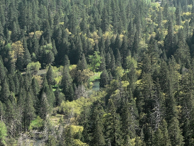
The story said scientists compared exquisitely detailed tree data collected in the 1920s and 1930s with tree surveys made between 2001 and 2010. They identified significant and rapid changes in basic forest structure. As large tree density fell across the state, and the density of small trees increased.
"The thing that I think is particularly worrisome is how widespread this is," said Maggi Kelley, UC Cooperative Extension specialist in the Department of Environmental Science, Policy and Management at UC Berkeley. "These changes will have an impact on how animals use the forest, how fire moves through the forest and the way we view the forest."
"Our grandkids will definitely see a difference," she said.
The Los Angeles Times also covered the new research, which will be published in the Proceedings of the National Academy of Sciences.
LA Times reporter Taylor Goldenstein spoke to study co-author Mark Schwartz, a professor of environmental science and policy at UC Davis and director of the John Muir Institute of the Environment. Schwartz said a denser forest allows fire to travel faster, causing more devastation. After a fire, new, smaller trees grow that are more likely to catch fire, and the cycle continues.
“These are historically fire-maintained ecosystems,” Schwartz said. “The firemen are faced with this notion of when a fire is reported and started, do they go out and bring out helicopters, trucks and people and put the fire out or do they let it burn?”
Just how much the change in forest structure is due to fire suppression and how much results from climate change is hard to tell because the two are interrelated, Schwartz said.
National Geographic magazine invoked Peter, Paul and Mary's mournful ballad in its headline, "Where have all the big trees gone? They've gone to logging and housing - but especially to climate change."
Reporter Warren Cornwall wrote that no area was immune to the forests' decline, from the foggy northern coast to the Sierra Nevada mountains to the San Gabriels above Los Angeles.
The loss of big trees was greatest in areas where trees had suffered the greatest water deficit. Large trees in general appear to be more vulnerable to a water shortfall. Though the 2011-14 drought might have an impact on forest change, it was not reflected in this study because the data was collected before the drought began.
New ANR IGIS statewide program to provide long-term data online
Dear Colleagues,
We are pleased to announce the development of a new statewide program called the ANR Informatics and Geographic Information Systems Statewide Program (IGIS). IGIS will organize, digitize and make Web-accessible some of California’s longest continuous data pertaining to agriculture and natural ecosystems, including weather and productivity related to management inputs — concrete data for modeling responses to change across the state.
IGIS will be supported and directed by a leadership team including Maggi Kelly (director), Lisa Fischer, Karl Krist and Joni Rippee, with key staff Shane Feirer, Kris Lynn-Patterson and Todd Perez. The responsibilities of the leadership team are to maintain IGIS direction, explore collaborations and maintain connection between ANR and UC campuses. The team will work with an advisory board that will assist the leadership team on all components of IGIS from data standardization and acquisition to data access and specific project selection and feedback from potential users.
Our vision is that over the next five years IGIS will provide a home for ANR’s rich and diverse collection of data, information and resources for academics and members of the public who rely on geospatial and informatics data, analysis and display.
In service of the ANR continuum, University of California researchers, academics from other institutions and the public, IGIS will provide the ability to connect with rich and diverse ANR resources, datasets and information through an online web accessible portal. IGIS will assist in applied research and extension activities that rely on geospatial data, analysis and display. IGIS will offer networking and collaboration and, when possible, provide training and research support on important agricultural and natural resource issues.
Specifically, IGIS will become the umbrella for ANR-wide GIS and informatics activities in order to
- Provide coordination for research and extension activities that require GIS and/or geospatial analysis
- Provide acquisition, storage and dissemination of large data sets from ANR Research and Extension Centers for researchers, managers and the public via Web-access (REC RAC, REC Web, Cal-EON)
- Create a virtual GIS and Informatics service center to provide for project level work that has Division-wide application (GIS Service Center)
For more information, please see our developing website http://ucanr.edu/sites/IGIS.
Barbara Allen-Diaz
Vice President, Agriculture and Natural Resources
View or leave comments for ANR Leadership.
This announcement is also posted and archived on the ANR Update pages.